Maps
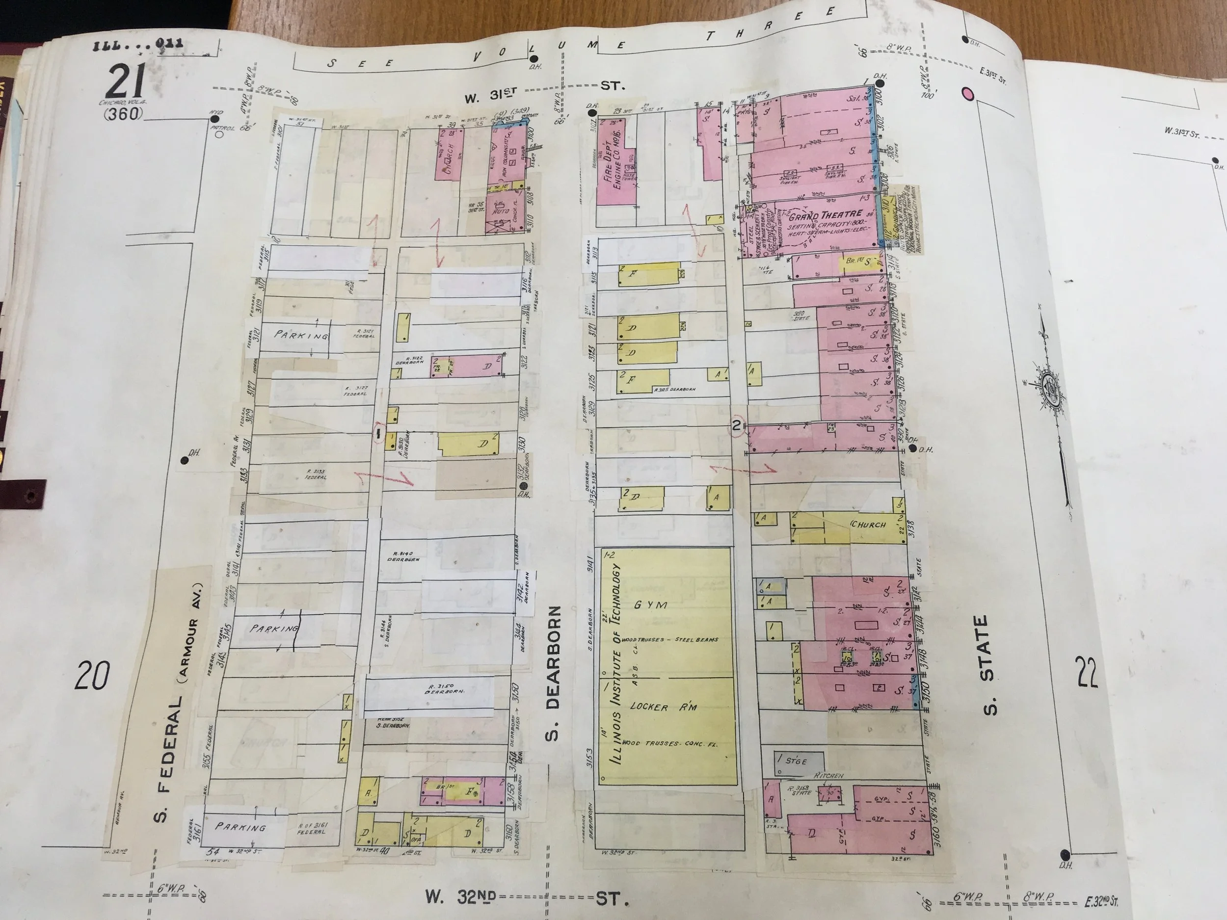
Shown here are maps displaying fast food’s dispersal in New York City at different points in time, and maps from the Sanborn Fire Insurance Company, which display the contexts in which fast food operated in Chicago and DC (and that apply elsewhere).
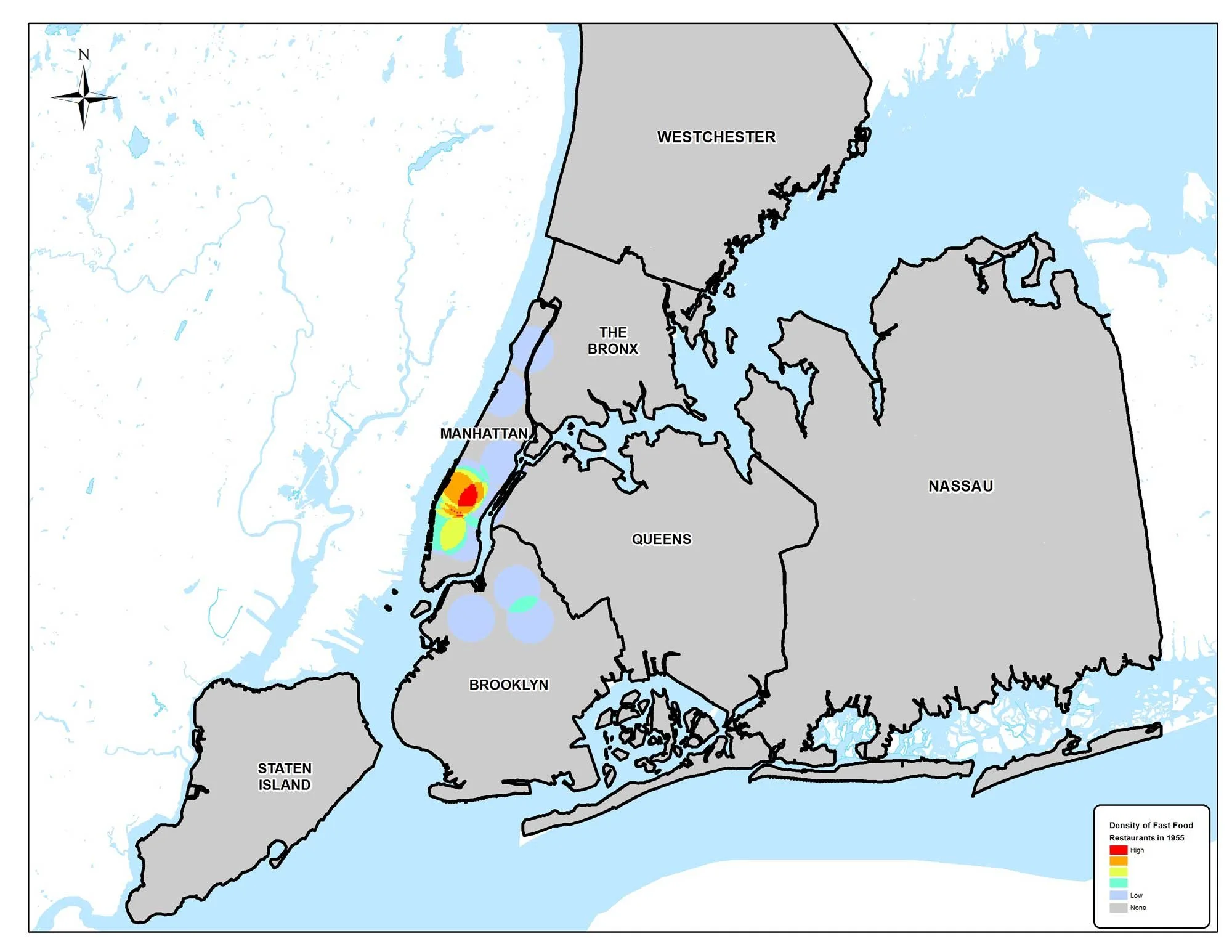
1955 Kernel Density: In 1955, fast food was scarce in New York City’s five boroughs, and essentially restricted to Manhattan. The restaurants in question were small burger outlets (called “burger chateaux” in the book) like White Castle. Map by Mapping Analytics, Rochester, NY.
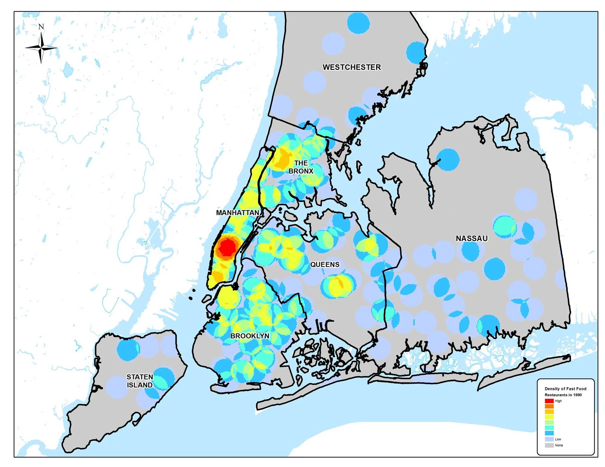
1990 Kernel Density: By 1990, fast food has exploded all across the city and surrounding neighborhoods in Westchester and Nassau Counties. Map by Mapping Analytics, Rochester, NY.
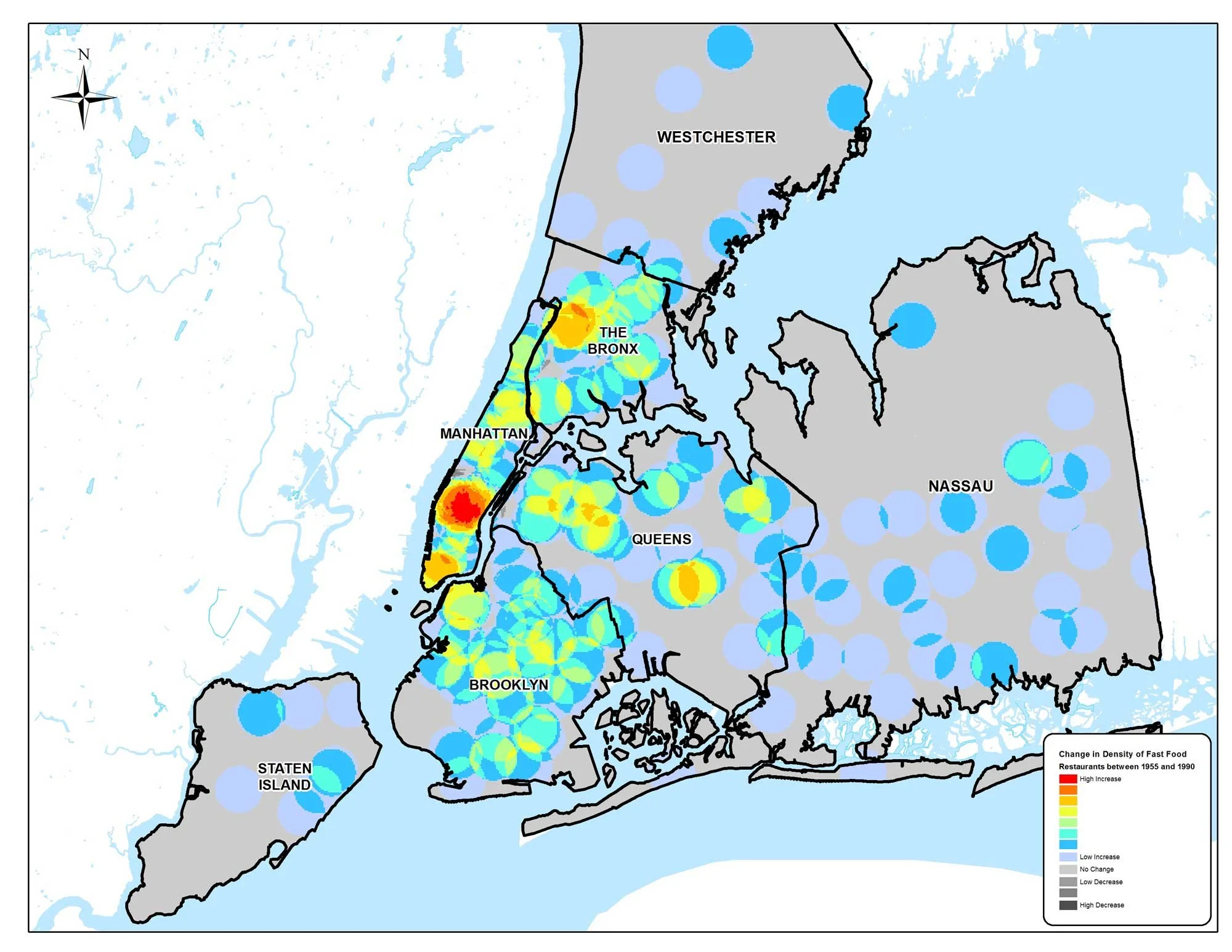
Change Kernel Density: This map shows the change in fast food density between 1955 and 1990. Map by Mapping Analytics, Rochester, NY.
A map of Armour, at the Chicago Stockyards. When the burger chateaux arose, they avoided the area near the stench of the stockyards--and also avoided Black neighborhoods. Source: Sanborn Maps, Library of Congress.
This photo is further downstream in the canal that was termed "Bubbly Creek," due to the bubbling of gases in the water from all the slaughterhouse refuse. Courtesy EDR, copyright holder of the Sanborn maps.
An example of how whole city blocks were remade under slum clearance. Fast food's early years were deeply affected by slum clearance and urban renewal. Courtesy EDR, copyright holder of the Sanborn maps.
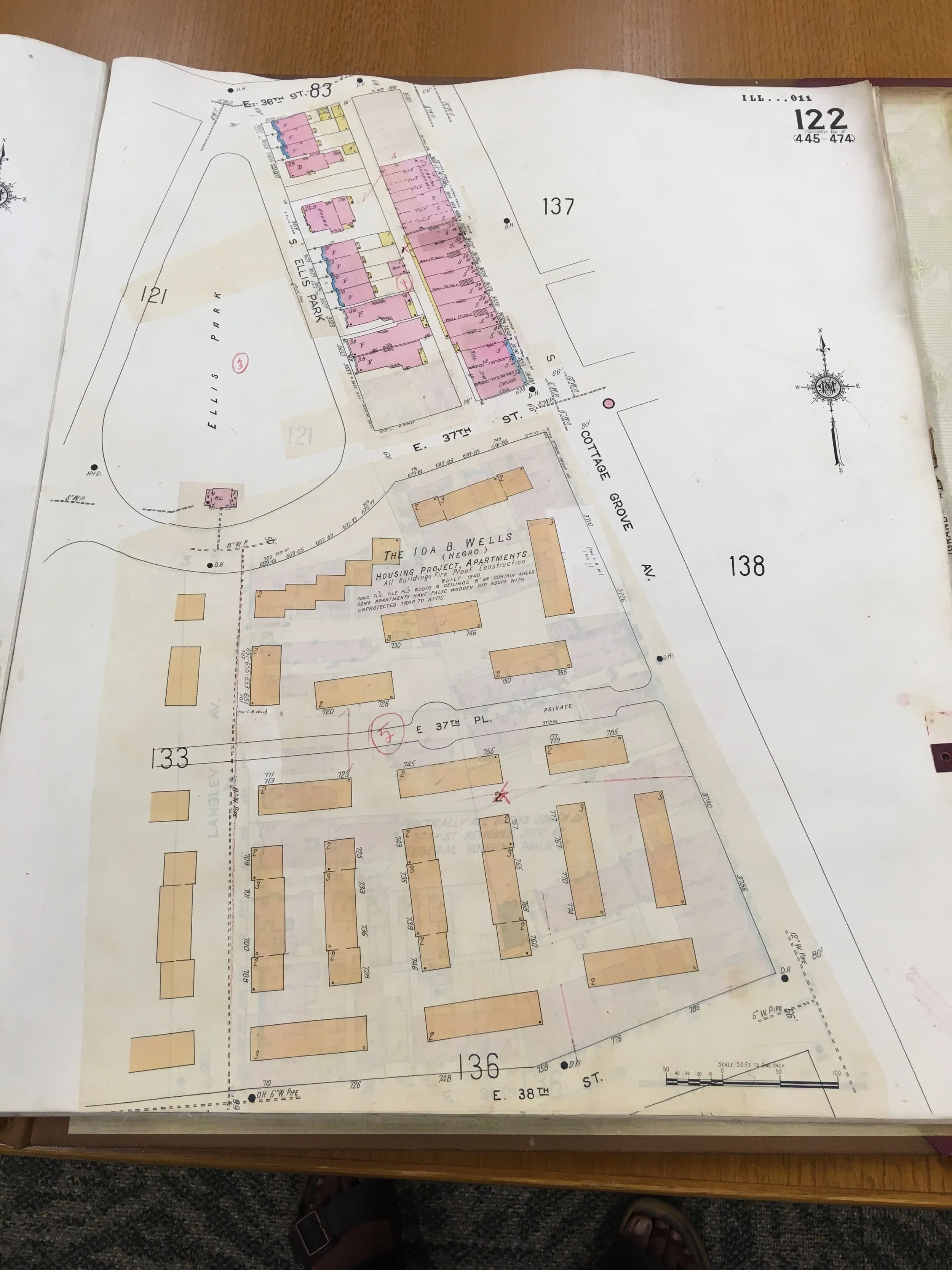
Building the Ida B. Wells housing projects in Chicago. Courtesy EDR, copyright holder of the Sanborn maps.
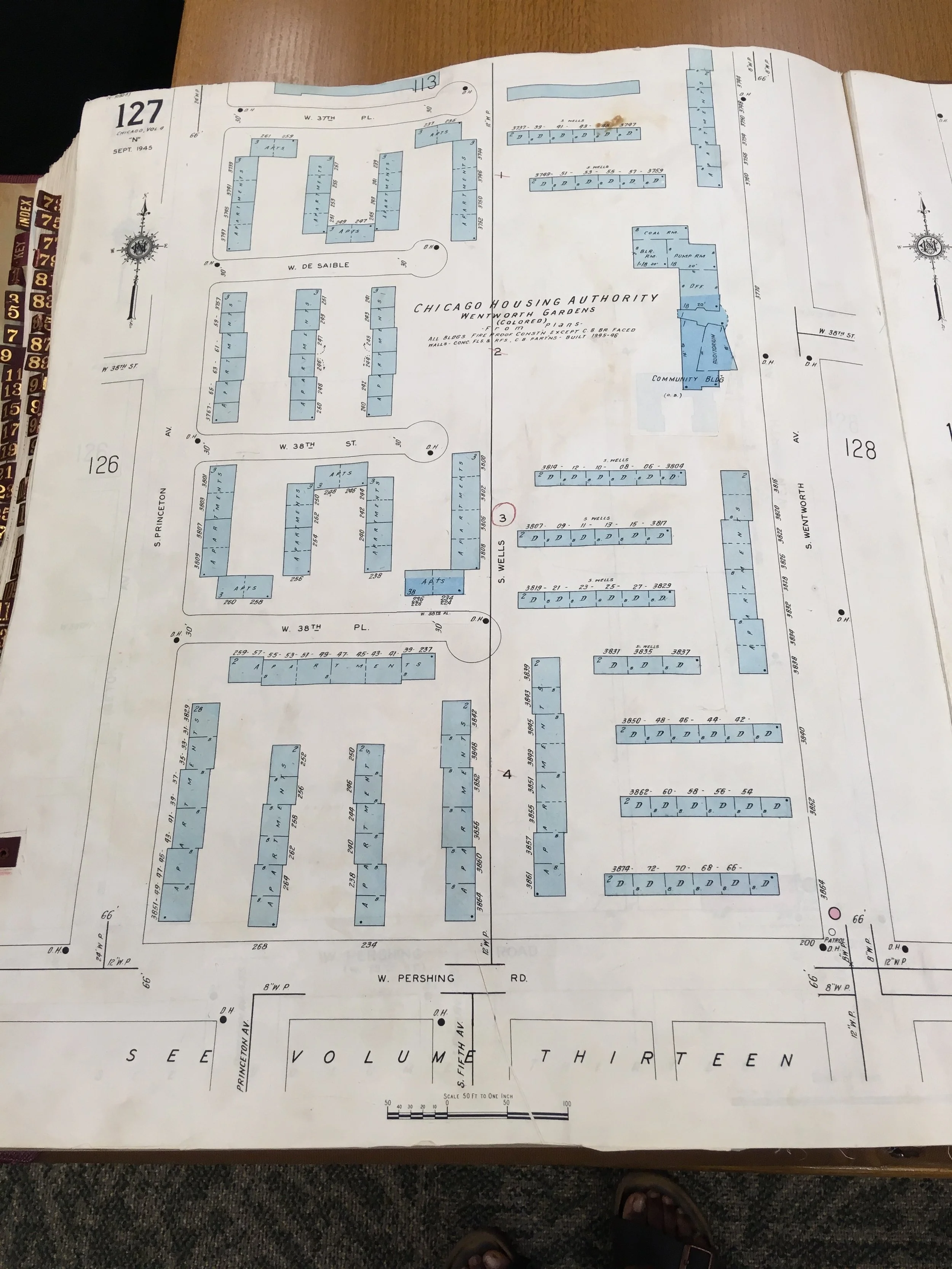
Building the Wentworth Gardens housing projects. Courtesy EDR, copyright holder of the Sanborn maps.
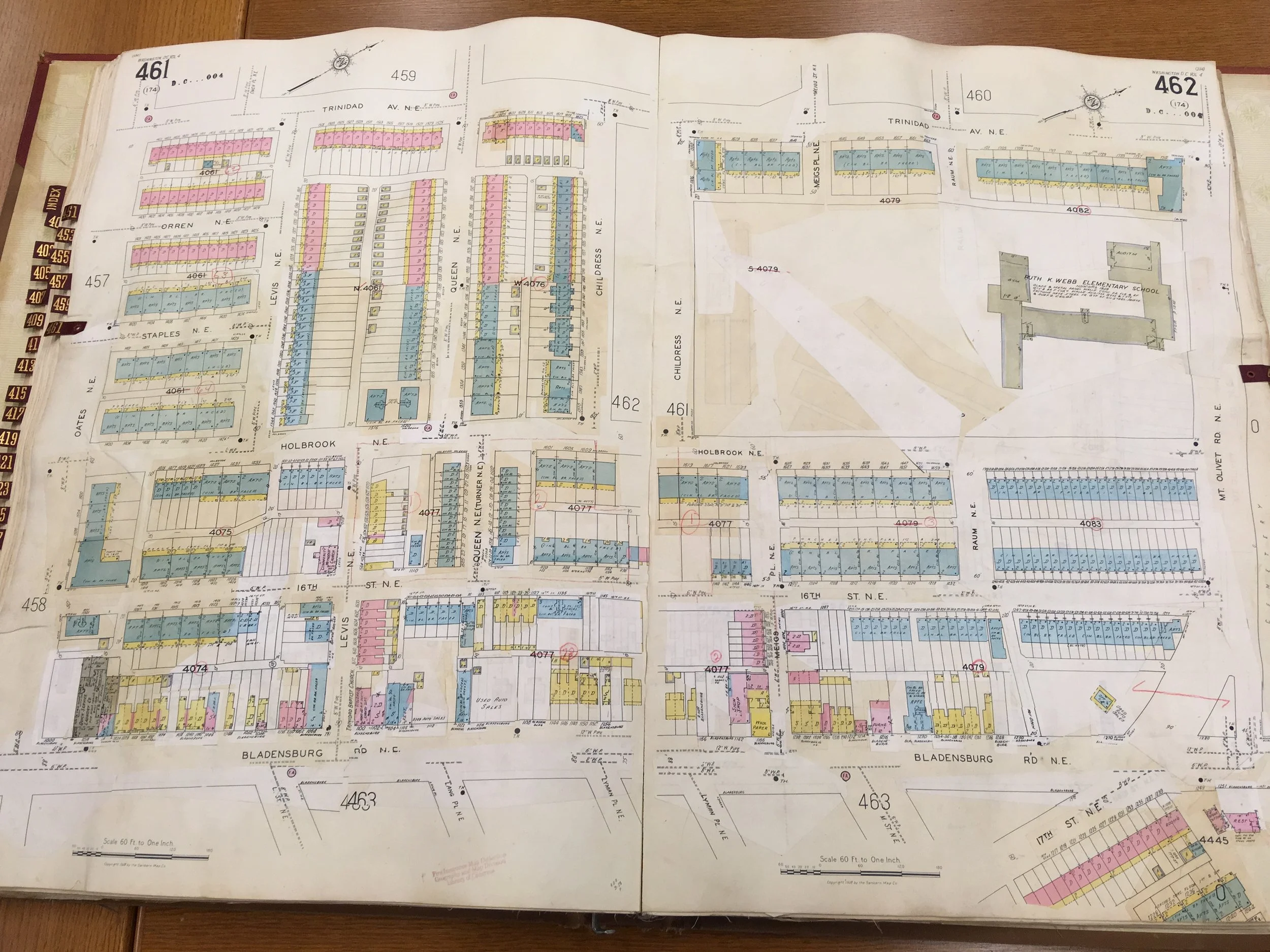
Bladensburg Rd. in Washington, DC. As described in the book, McDonald's launched its second franchise (after Des Plaines, IL) in the DC metro. The outlet at 1164 Bladensburg Rd. became a "problem store" that corporate directed to African American franchisees. Courtesy EDR, copyright holder of the Sanborn maps.
